Jumbo Content

Applications Capability Matrix

The PACE mission will advance the state of the art of satellite-driven Earth science, while fulfilling tangible needs of society. The PACE Applications program provides real-world context for the mission and establishes the utility and relevance of this next-generation Earth-observing satellite to decision-makers. The PACE Applications Capability Matrix asks fundamental applied science questions and demonstrates how PACE Early Adopters and Science and Applications Team members are working to solve them.

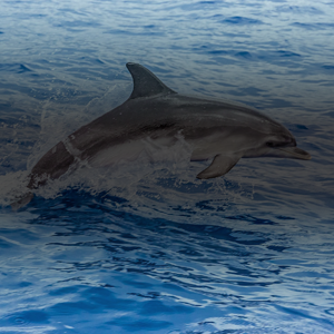
Can marine mammal activity serve as an indicator of a changing climate?

Overview

PI: Elizabeth FergusonApplication ConceptApplication GoalCategoryHost Agency and Potential UsersARL
Elizabeth FergusonCombine in situ & satellite data to assess ecological characteristics associated with marine mammal occurrence & the impacts of climate change on indicator speciesAdvance marine mammal monitoring & understanding of indicator species; Extend spatial domain & temporal capacity of marine mammal monitoring in coastal OregonWater Resources
Early Adopter: Ocean Science Analytics
End Users: Commercial & recreational fishing industry; online training community
1

Read More

PI: Elizabeth Ferguson
Mission Data Product
(provisional and test products in italics; view data products table)
Mission Performance CharacteristicsSAT PartnerAncillary Measurements
Chla, fluorescence line height, NPP, phytoplankton pigment concentrations, phytoplankton community compositionPACE OCI is expected to produce highly accurate measurements related to phytoplankton in coastal oceans (~1.1 km spatial resolution at nadir) every 1-2 daysToby WestberryIn situ Chla, pH, pCO2, bio-acoustic data, SST

How do ocean organisms affect the atmosphere and coastal air quality?

Overview

PI: Daniel TongApplication ConceptApplication GoalCategoryHost Agency and Potential UsersARL
Daniel TongCombine hyperspectral satellite data of phytoplankton communities with polarimetric retrievals of trace gases & aerosols in the atmosphereImprove the accuracy of global & regional air quality predictionAir Quality
Early Adopter: George Mason University
End Users: National Weather Service; air quality and climate research community
3

Read More

PI: Daniel Tong
Mission Data Product
(provisional and test products in italics; view data products table)
Mission Performance CharacteristicsSAT PartnerAncillary Measurements
Aerosol fine mode fraction (over ocean), Chla, daily PAR, water path of liquid and ice clouds, cloud phase, optical thickness of liquid and ice clouds, spectral aerosol optical depth, instantaneous PAR, cloud top heightPACE aerosol and cloud data will be used to estimate the effect of maritime aerosols on ocean ecosystems & cycling of organic matter in the ocean but using models that correlate aerosol characteristics & abundance to such properties as OCI chlorophyll & phytoplankton concentrationPengwang Zhai; Jacek ChowdharyWind, air temperature, Goddard Modeling & Assimilation Office's MERRA model outputs

What are the long-term changes in air quality and pollutants? How do they vary with climate change?

Overview

PI: Mariusz PagowskiApplication ConceptApplication GoalCategoryHost Agency and Potential UsersARL
Mariusz PagowskiUse hyperspectral remote sensing data to constrain aerosol concentrations within the FV3-GF5/GOCART modelImprove the global climate model's ability to estimate aerosols states & their impact on weather and climateAir Quality; Climate
Early Adopter: National Oceanic and Atmospheric Administration
End Users: NOAA Climate Prediction Office: Modeling, Analysis, Predictions, and Projections Program; NOAA Office of Weather and Air Quality
2

Read More

PI: Mariusz Pagowski
Mission Data Product
(provisional and test products in italics; view data products table)
Mission Performance CharacteristicsSAT PartnerAncillary Measurements
Aerosol fine mode fraction (over ocean), spectral aerosol optical depth, aerosol single scattering albedoPACE polarimeters will provide a number of spectral aerosol properties, along with model data that will be used to identify aerosol types & correlate variations in climate with long term trends of aerosol types such as sulfates, dust, smoke, sea salt, organic carbon, & black carbonSnorre Stames; Jacek Chowdhary; Lorraine RemerFV3-GF5/GOCART model, JEDI assimilation toolkit, Goddard Modeling & Assimilation Office's MERRA-2 analysis

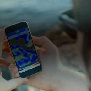
Can user-friendly mobile and desktop apps support near-real-time decision making and resource management?

Overview

PI: Marina MarrariApplication ConceptApplication GoalCategoryHost Agency and Potential UsersARL
Marina MarrariDigest satellite data into mobile app serving near-real-time fisheries productsEnable advanced & continuous mobile app data, related to phytoplankton community structure & red tides, for usersWater Resources
Early Adopter: La Federación Costarricense de Pesca
End Users: Recreational anglers, commercial fishermen, tourism agents, non-government organizations, academia
3

Read More

PI: Marina Marrari
Mission Data Product
(provisional and test products in italics; view data products table)
Mission Performance CharacteristicsSAT PartnerAncillary Measurements
Chla, NPP, phytoplankton community compositionPACE OCI will provide hyperspectral measurements, related to phytoplankton & algal blooms, for coastal oceans every 1 to 2 days with a data latency of 6-12 hoursBrian BarnesSST, currents, sea level anomalies, bathymetry, mixed layer depth, tide forecasts, moon phase

Overview

PI: Vardis TsontosApplication ConceptApplication GoalCategoryHost Agency and Potential UsersARL
Vardis TsontosIngestion of hyperspectral ocean color products within COVERAGE as a complement to current baseline set of global interagency datasets for the range of key ocean parametersEnable use of advanced ocean products via COVERAGE in support of population & biodiversity responses to environmental variability & climate, species habitat characterization & utilization, by-catch mitigation, fishing closed area & marine protected areasWater Resources
Early Adopter: NASA JPL
End Users: GEO-Marine Biodiversity Observation Network; GEO-Blue Planet; GOOS-AniBOS; Sargasso Sea Commission; Inter-American Tropical Tuna Commission
4

Read More

PI: Vardis Tsontos
Mission Data Product
(provisional and test products in italics; view data products table)
Mission Performance CharacteristicsSAT PartnerAncillary Measurements
Spectral remote sensing reflectance (Rrs), Fluorescence line height, Spectral diffuse attenuation coefficients (Kd), Spectral CDOM absorption, Chla, NPP, Phytoplankton community compositionPACE OCI will offer highly accurate (high signal to noise) hypespectral measuremetns in coastal environments enabling validation/tuning of hypespectral algorithms every 1 to 2 daysChuanmin HuIn situ HPLC Chla (from SEABASS, EXPORTS, CORALS)

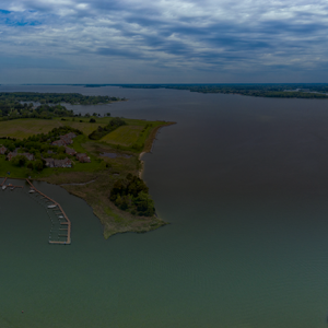
How does water clarity information help monitor estuary health, river outflow, and manage resources?

Overview

PI: Jessica TurnerApplication ConceptApplication GoalCategoryHost Agency and Potential UsersARL
Jessica TurnerUse hyperspectral remotely sensed data to improve estimation of water clarity & suspended particle size estimation in the Chesapeake BayBetter estimation of water clarity & advanced water quality benchmarking for the Chesapeake Bay watershedWater Resources
Early Adopter: University of Connecticut, Department of Marine Sciences
End Users: Chesapeake Bay Program Modeling Workgroup & Scientific, Technical Assessment & Reporting Workgroup; Virginia Shellfish Aquaculture Industry Advisory Committee
3

Read More

PI: Jessica Turner
Mission Data Product
(provisional and test products in italics; view data products table)
Mission Performance CharacteristicsSAT PartnerAncillary Measurements
Chla, POC, spectral Rrs, spectral bbp coefficients, spectral Kd, spectral non-algal particles plus DOM absorption coefficients, spectral phytoplankton absorption, instantaneous PAR, NPP, spectral CDOM absorption, spectral slope coefficients of CDOM absorption, phytoplankton pigment concentrations, concentration of phytoplankton carbon, concentration of DOC, suspended particulate matter, ocean surface refractive indexPACE OCI will offer highly accurate (high signal to noise) hypespectral measuremetns in coastal environments enabling estimation of water clarity/quality every 1 to 2 daysRobert Frouin; Emmanuel BossIn situ measurements from the Chesapeake Bay Program and model output, simulated data in coastal waters

Overview

PI: Jason JolliffApplication ConceptApplication GoalCategoryHost Agency and Potential UsersARL
Jason JolliffUse hyperspectral data to retrieve true-color water clarity indices to better constrain high-temporal geostationary dataInformed monitoring of river plume outflows and coastal water clarity to enhance civilian and military operations and resource managementWater Resources
Early Adopter: U.S. Naval Research Laboratory
End Users: NRL-Ocean Modeling and Prediction Branch
3

Read More

PI: Jason Jolliff
Mission Data Product
(provisional and test products in italics; view data products table)
Mission Performance CharacteristicsSAT PartnerAncillary Measurements
Rrs, Kd, bbp, spectral top-of-atmosphere radiances from OCIPACE OCI will offer highly accurate (high signal to noise) hypespectral measuremetns in coastal environments every 1 to 2 daysMichael TwardowskiGOES-R ABI visible band data & other geostationary satellite data

Overview

PI: Michael OndrusekApplication ConceptApplication GoalCategoryHost Agency and Potential UsersARL
Michael OndrusekUse hyperspectral data to reconfigure & optimize TSM algorithms for a wide range of inland and coastal watersImproved ability to quantify TSM concentrations under different environmental conditionsWater Resources
Early Adopter: National Oceanic and Atmospheric Administration
End Users: Maryland Department of Natural Resources; NOAA Coastwatch
2

Read More

PI: Michael Ondrusek
Mission Data Product
(provisional and test products in italics; view data products table)
Mission Performance CharacteristicsSAT PartnerAncillary Measurements
Rrs, Chla, Kd, spectral non-algal particles plus DOM absorption coefficients, bbp, suspended particulate matter, spectral slope coefficients of CDOM absorption, spectral CDOM absorptionPACE OCI will offer highly accurate (high signal to noise) hypespectral measuremetns in coastal environments enabling validation/tuning of hypespectral algorithms every 1 to 2 daysNima Pahlevan and Michael TwardowskiIn situ measurements of hyperspectral Rrs, chla, absorption and scattering coefficients, Kd, phytoplankton composition, and AOD

Can air quality alerts, warnings, and forecasts be enhanced to better support human health?

Overview

PI: Madhusudan AnandApplication ConceptApplication GoalCategoryHost Agency and Potential UsersARL
Madhusudan AnandUse hypspectral & polarimetric cloud and aerosol data to inform air quality in India.Advanced air quality modelling in India including improved aerosol emissions, forecasting visibility, understanding extreme temperatures, accounting for carbon emissions and climate risk, predicting health impactsAir Quality
Early Adopter: Datair Tech. PVT LTD
End Users: Bayer; InkRepubliq; NIKE; Brigade Group
4

Read More

PI: Madhusudan Anand
Mission Data Product
(provisional and test products in italics; view data products table)
Mission Performance CharacteristicsSAT PartnerAncillary Measurements
Aerosol fine mode fraction (over ocean), Cloud mask, Cloud phase, Optical thickness of liquid and ice clouds, Cloud top pressure of opaque clouds, Cloud detection, Cloud physical thickness, Cloud top height, Liquid cloud optical depth, Liquid cloud droplet effective radius, Liquid cloud droplet effective variance, Thin cloud contamination, Spectral aerosol optical depth, aerosol number concentration, aerosol size distribution, aerosol complex refractive index, aerosol layer height, aerosol shape-fractional spherical, aerosol single scattering albedo, Aerosol optical depth in the near-infrared, Ocean surface refractive indexPACE data will also be used to identify aerosol types and locate aerosol layers in the vertical and estimate boundary layer height enabling estimation of PM2.5 near the surface.Alexei Lyapustin; Lorraine Remer; Snorre StamnesIn situ air quality data, NO2, SO2, OZONE, CO, and other pollutant data, Methane Plume data, CO2, Water Vapor, air temperature, altitude, pressure, humidity, wind, in situ weather station data, radiation and heat flux data, fire data, land use and land surface data

Overview

PI: Heather HolmesApplication ConceptApplication GoalCategoryHost Agency and Potential UsersARL
Heather HolmesUse hyperspectral remote sensing data to track wildfire plumes, improve emissions modeling, & determine pollutant sourcesImprove air quality & exposure models of elevated PM2.5 concentrations in the western United States. Provide more accurate and refined smoke forecasts, air quality alerts & advisoriesAir Quality
Early Adopter: University of Utah
End Users: Washoe County Air Quality Management Division; University of Nevada Living With Fire Program; Western States Air Resources Council; Western Regional Air Partnership
2

Read More

PI: Heather Holmes
Mission Data Product
(provisional and test products in italics; view data products table)
Mission Performance CharacteristicsSAT PartnerAncillary Measurements
Aerosol fine mode fraction (over ocean), spectral aerosol optical depth, aerosol number concentration, aerosol size distribution, aerosol complex refractive index, aerosol layer height, aerosol shape-fractional spherical, aerosol single scattering albedoPACE data will be used to locate aerosol layers in the vertical and estimate boundary layer height enabling estimation of PM2.5 near the surface. PACE data will also be used to identify aerosol types, in particular smoke plumes, to improve smoke transport & deposition models that will inform the impact of wildfires on air quality.Alexei LyapustinWind, air temperature, fire radiative power, soil moisture, in situ observations, Goddard Modeling & Assimilation Office's MERRA model outputs

Overview

PI: S. Marcela Loría-SalazarApplication ConceptApplication GoalCategoryHost Agency and Potential UsersARL
S. Marcela Loría-SalazarUse and evaluation of hypespectral & polarimetric aerosol data to advance smoke air quality modelsAdvance air quality models to better inform public health alerts in the Southern Great Plains region of the United States and additional understanding the role of aerosols in regional weatherAir Quality
Early Adopter: Univ. of Oklahoma
End Users: Oklahoma MESONET Fire Network; Oklahoma Air Quality Division
4

Read More

PI: S. Marcela Loría-Salazar
Mission Data Product
(provisional and test products in italics; view data products table)
Mission Performance CharacteristicsSAT PartnerAncillary Measurements
Aerosol fine mode fraction (over ocean), Spectral aerosol optical depth, aerosol number concentration, aerosol size distribution, aerosol complex refractive index, aerosol layer height, aerosol shape-fractional spherical, aerosol single scattering albedoPACE data will be used to locate aerosol layers in the vertical and estimate boundary layer height enabling estimation of PM2.5 near the surface. PACE data will also be used to identify aerosol types, in particular smoke plumes, to improve smoke transport & deposition models that will inform the impact of wildfires on air quality.Alexei LyapustinIn situ AERONET spectral aerosol and water vapour measurements, surface PM2.5 mass concentrations measurements, MODIS & VIIRS AOD, VIIRS Deep Blue (DB), plume injection height (PIH) ASHE & MAIAC retrievals

When oil leaks, seeps, or spills into the environment, how do we know its amount and impact?

Overview

PI: Chuanmin Hu Application ConceptApplication GoalCategoryHost Agency and Potential UsersARL
Chuanmin Hu Use hyperspectral remote sensing data to differentiate oil types & amountsImproved detection, differentiation, & estimation of oil thickness/depth for oil seeps/spillsDisasters
Early Adopter: University of South Florida
End Users: Oil management agencies; NOAA NRDA; NOAA CoastWatch; USEPA
1

Read More

PI: Chuanmin Hu
Mission Data Product
(provisional and test products in italics; view data products table)
Mission Performance CharacteristicsSAT PartnerAncillary Measurements
Rrs, ocean surface roughness, ocean surface refractive indexPACE polarimeters will provide observations in UV, visible, NIR, and IR spectral region (380 - 1000 nm) and in the SWIR spectral region (1.2 and 1.6 mm) to spectrally differentiate various types of oil slicks & quantify oil thicknessMatteo OttavianiHyperspectral Rrs measurements (in situ, airborne), oil collection samples, wind, SSH

How does coastal water quality affect aquaculture site selection and fishery operations?

Overview

PI: Damian BradyApplication ConceptApplication GoalCategoryHost Agency and Potential UsersARL
Damian BradyRelate remotely sensed phytoplankton size to bivalve feeding rates to inform offshore site selection in MaineProvide more relevant information for aquaculture site selection in Maine's estuariesWater Resources; Ecological Forecasting
Early Adopter: University of Maine
End Users: Limited purpose aquaculture license holders in Maine
4

Read More

PI: Damian Brady
Mission Data Product
(provisional and test products in italics; view data products table)
Mission Performance CharacteristicsSAT PartnerAncillary Measurements
Chla, fluorescence line height, NPP, phytoplankton pigment concentrations, phytoplankton community compositionPACE OCI will deliver hyperspectral measurements of phytoplankton characteristics in coastal environments with a ground track spacing of ~1.1 kilometers every 1 to 2 daysEmmanuel BossSST, currents, SSH, bathymetry, thermocline depth, tide forecasts

Overview

PI: Marié SmithApplication ConceptApplication GoalCategoryHost Agency and Potential UsersARL
Marié SmithIntegrate hyperspectral phytoplankton data into phytoplankton IOP model for a fisheries & aquaculture decision-support toolSupport small scale commercial and subsistence fishing in South African waters & identify productive areas for fishingWater Resources; Ecological Forecasting
Early Adopter: Council of Scientific & Industrial Research
End Users: Aquaculture farms; local municipalities; desalination plants; fisherpeople; CSIR and Southern Ocean Carbon & Climate Observatory
3

Read More

PI: Marié Smith
Mission Data Product
(provisional and test products in italics; view data products table)
Mission Performance CharacteristicsSAT PartnerAncillary Measurements
Chla, Rrs, Fluorescence line height, NPP, phytoplankton pigment concentrations, phytoplankton community compositionPACE OCI will deliver hyperspectral measurements of phytoplankton characteristics in coastal environments with a ground track spacing of ~1.1 kilometers every 1 to 2 daysPeter Gaube; Alison ChaseSentinel-3 OLCI reflectance products, in situ phytoplankton counts, SST from MODIS, VIIRS & SLSTR

What risks do climate extremes and natural disasters pose to food security, coasts, and wetland ecosystems?

Overview

PI: Jordan BorakApplication ConceptApplication GoalCategoryHost Agency and Potential UsersARL
Jordan BorakUse hyperspectral satellite data to resolve spectral characteristics of surface vegetation (predictor of surface permeability and runoff during extreme rain events)Improved understanding of wetland ecosystem health & structure (during flood events) in the Chesapeake Bay & southeastern VirginiaTerrestrial Resources; Ecological Forecasting
Early Adopter: University of Maryland
End Users: Chesapeake Bay water quality managers and run-off modelers; coastal Virginia and Maryland city managers and disaster/flooding responders
2

Read More

PI: Jordan Borak
Mission Data Product
(provisional and test products in italics; view data products table)
Mission Performance CharacteristicsSAT PartnerAncillary Measurements
Surface reflectance, NDVI, BRDF/albedo and model parameters, land surface BRDFPACE OCI will provide high-resolution spectral information (5 nm) in the UV & NIR regions of the spectrum capable of identifying spectral characteristics of surface vegetationFred HuemmrichICESat-2 vegetation/land heights and inland water product, NWI wetlands designations, MODIS land cover, high-resolution gridded DEM

Overview

PI: Anastasia RomanouApplication ConceptApplication GoalCategoryHost Agency and Potential UsersARL
Anastasia RomanouAssimilate satellite retrievals of phytoplankton productivity & community composition into global climate modelsImprove global climate models for risk analysis to protect natural and food resources against current & future climate extremesClimate; Water Resources
Early Adopter: NASA Goddard Institute for Space Studies/Columbia University
End Users: World Wildlife Fund; United Nations Disaster Risk Reduction Office; United Nations Development Program; Wildlife Conservation Society
3

Read More

PI: Anastasia Romanou
Mission Data Product
(provisional and test products in italics; view data products table)
Mission Performance CharacteristicsSAT PartnerAncillary Measurements
Chla, daily PAR, Rrs, Kd, spectral non-algal particles plus DOM absorption coefficients, bbp, spectral phytoplankton absorption coefficients, POC, instantaneous PAR, NPP, CDOM absorption, phytoplankton pigment concentrations, phytoplankton community composition, concentration of phytoplankton carbon, DOC, suspended particulate matterPACE OCI is expected to produce hyperspectral observations, including phytoplankton characertistics, for global oceans with a footprint of ~1.1 kilometers every 1 to 2 days, available within 6-12 hoursPeter Gaube, Cecile Rousseaux, and Patricia CastellanosSST, SSH, precipitation, riverine outflow, Chla, NPP, MERRA-2 atmospheric conditions fields, Model-E model daily simulation climate data, ECCO data

Where do algal blooms occur? How do environmental factors enhance and respond to algal blooms?

Overview

PI: Clarissa AndersonApplication ConceptApplication GoalCategoryHost Agency and Potential UsersARL
Clarissa AndersonApply satellite data to California HAB forecasting tool (C-HARM) to protect ecosystem health & understand coastal ocean ecological dynamicsImprove coastal California HAB model products for water resource managers & federal, state, regional partners & decision-makersWater Resources; Ecological Forecasting
Early Adopter: Scripps Institution of Oceanography
End Users: Marine mammal resource managers; shellfish growers; the California Department of Fish and Wildlife; California Department of Public Health; California Office of Environmental Health and Hazard Assessment; fisherfolk
5

Read More

PI: Clarissa Anderson
Mission Data Product
(provisional and test products in italics; view data products table)
Mission Performance CharacteristicsSAT PartnerAncillary Measurements
Chla, spectral top-of-atmosphere radiances from OCI, fluorescence line height, NPP, phytoplankton pigment concentrations, phytoplankton community compositionPACE OCI is expected to produce hyperspectral observations, related to phytoplankton & algal blooms, for coastal oceans every 1 to 2 days, available within 6-12 hoursDave SiegelSST, winds, currents, SSH, model output, buoy data, simulated data over coastal California

Overview

PI: Richard StumpfApplication ConceptApplication GoalCategoryHost Agency and Potential UsersARL
Richard StumpfUse hyperspectral Rrs to separate out bloom types in turbid coastal & estuarine environmentsTargeted HAB management to advise state managers, local health department, water treatment operators, aquaculture & commercial fisheriesWater Resources
Early Adopter: National Oceanic and Atmospheric Administration
End Users: State managers in Florida, Maryland, Virginia, Ohio, California
3

Read More

PI: Richard Stumpf
Mission Data Product
(provisional and test products in italics; view data products table)
Mission Performance CharacteristicsSAT PartnerAncillary Measurements
Rrs, bbp, spectral non-algal particle plus DOM absorption coefficients, Chla, fluorescence line height, NPP, phytoplankton pigment concentrations, phytoplankton community composition, ocean body propertiesPACE OCI will produce highly accurate observations of phytoplankton characteristics & water inherent optical properties enabling separation of bloom types in coastal waters (~1.1 km spatial resolution at nadir) every 1 to 2 daysRobert ShuchmanIn situ data and laboratory analysis, in situ hyperspectral radiances, Sentinel 2-3 satellite data, simulated data in coastal waters

Overview

PI: Salem Ibrahim SalemApplication ConceptApplication GoalCategoryHost Agency and Potential UsersARL
Salem Ibrahim SalemCombine in situ water quality data with hyperspectral satellite data to develop HAB estimation models for inland & coastal watersImproved detection of HABs, red tides, and blue tides in coastal areas and lakes of Japan, Indonesia, and ThailandWater Resources
Early Adopter: Kyoto University of Advanced Science
End Users: Ministry of Land, Infrastructure, Transport, & Tourism, Government of Japan; Port & Airport Research Institute; Marine Environmental Information Group; Chiba Prefectural Fisheries Research Center
3

Read More

PI: Salem Ibrahim Salem
Mission Data Product
(provisional and test products in italics; view data products table)
Mission Performance CharacteristicsSAT PartnerAncillary Measurements
Chla, spectral top-of-atmosphere radiances from OCI, fluorescence line height, Rrs, daily PAR, bbp, spectral phytoplankton absorption coefficients, spectral non-algal particle plus DOM absorption coefficients, fluorescene line height, NPP, phytoplankton pigment concentrations, phytoplankton community composition, suspended particulate matter, CDOM absorption, spectral slope coefficients of CDOM absorption, POC, PIC, spectral aerosol optical depthPACE OCI will produce highly accurate observations of phytoplankton characteristics & water inherent optical properties enabling separation of bloom types in coastal waters (~1.1 km spatial resolution at nadir) every 1 to 2 daysNima PahlevanIn situ Rrs, Kd, CDOM, bbp, Chla, AOD, TSS, and phytoplankton absorption; HICO satellite observations

Overview

PI: Moritz LehmannApplication ConceptApplication GoalCategoryHost Agency and Potential UsersARL
Moritz LehmannCombine in situ phytoplankton abundance & pigment analysis with satellite data to support routine monitoring of bloom eventsImprove HAB alert systems & better inform the restoration activities in New Zealand watersWater Resources
Early Adopter: Xerra
End Users: Environment Canterbury Bay of Plenty Regional Council; Waikato Regional Council; New Zealand Antarctic Science Platform
2

Read More

PI: Moritz Lehmann
Mission Data Product
(provisional and test products in italics; view data products table)
Mission Performance CharacteristicsSAT PartnerAncillary Measurements
Chla, spectral top-of-atmosphere radiances from OCI, fluorescence line height, Rrs, Kd, NPP, phytoplankton pigment concentrations, phytoplankton community composition, suspended particulate matterPACE OCI will produce highly accurate observations of phytoplankton characteristics & in water constituents enabling identification of bloom types in coastal waters every 1 to 2 daysPeter Gaube; Alison ChaseIn situ hyperspectral surface reflectance, phytoplankton species counts, multispectral and hyperspectral reflectance from UAV-borne sensors, water constituents (CDOM, Chla, phycocyanin)

Overview

PI: Fernanda MacielApplication ConceptApplication GoalCategoryHost Agency and Potential UsersARL
Fernanda MacielUse hyperspectral data to understand suspended sediments and detect cyanobacteria HABs in the Río de la Plata Estuary, UruguayImprove detection and quantification of cyanobacteria in the Río de la Plata EstuaryWater Resources
Early Adopter: Universidad de la República, Uruguay
End Users: Uruguay Ministry of the Environment; Río de la Plata Managing Agency; Ministry of Livestock, Agriculture, and Fisheries; Department of Environmental Development, Municipality of Montevideo
3

Read More

PI: Fernanda Maciel
Mission Data Product
(provisional and test products in italics; view data products table)
Mission Performance CharacteristicsSAT PartnerAncillary Measurements
Chla, Spectral top-of-atmosphere radiances from OCI, Rrs, daily PAR, bbp, Spectral phytoplankton absorption coefficients, Spectral non-algal particle plus DOM absorption coefficients, Phytoplankton pigment concentrations, Phytoplankton community composition, Suspended particulate matter, CDOM absorptionPACE OCI will produce highly accurate observations of phytoplankton characteristics & water inherent optical properties enabling separation of bloom types in coastal waters (~1.1 km spatial resolution at nadir) every 1 to 2 days.Mike Twardowski, Dave Siegel, and Nima PahlevanIn situ Chla, biovolume of cyanobacteria (total and percentage of total phytoplankton), Chla fluorescence, phycocyanin fluorescence, DOM fluorescence, CDOM absorption, turbidity, particle size distribution, SST, conductivity/salinity, depth, significant wave height, daily discharge of main tributaries, wind speed

Overview

PI: Joaquim GoesApplication ConceptApplication GoalCategoryHost Agency and Potential UsersARL
Joaquim GoesIngest hyperspectral ocean color and aerosol data into Noctiluca specific ocean color algorithms for coastal waters of OmanIncreased prediction of hypoxia and species level HABs (Noctiluca) in Oman, enabling the possibility of not only forecasting fish kill events, but the follow-up analysis of their causeWater Resources; Ecological Forecasting
Early Adopter: Columbia University
End Users: Ministry of Agriculture and Fisheries Wealth, Oman; Ministry of Environment and Climate Affairs, Oman; Desalination plants, Aquaculture, Oil Refineries, Shipbuilding and Tourism companies
7

Read More

PI: Joaquim Goes
Mission Data Product
(provisional and test products in italics; view data products table)
Mission Performance CharacteristicsSAT PartnerAncillary Measurements
Chla, Spectral top-of-atmosphere radiances from OCI, spectral phytoplankton absorption coefficients, spectral particle backscattering coefficients, Fluorescence line height, Rrs, Kd, NPP, Phytoplankton pigment concentrations, phytoplankton community composition, Suspended particulate matter, PAR, spectral aerosol optical depth, ocean roughnessPACE OCI will produce highly accurate observations of phytoplankton characteristics and in water constituents enabling identification of bloom types in coastal waters every 1 to 2 daysHeidi DierssenSST, SSH, SLA, Outputs from a coupled physical-biogeochemical model (NRL's NCOM-COSiNE; NASA ECCO)

How does climate change impact water-borne pathogens in coastal waters and estuaries?

Overview

PI: Antar JutlaApplication ConceptApplication GoalCategoryHost Agency and Potential UsersARL
Antar JutlaEnhance Vibrio risk models by integrating hyperspectral remotely sensed plankton & plankton health data into algorithms for Florida and the Chesapeake BayBetter understanding of the relationship between plankton & Vibrio spp. bacteria to improve 1) risk assessment of infections, & 2) improve advisoriesWater Resources; Public Health; Ecological Forecasting
Early Adopter: University of Florida
End Users: United Nations Office for Coordinator of Humanitarian Affairs; World Health Organization; United Nations International Children's Emergency Fun
4

Read More

PI: Antar Jutla
Mission Data Product
(provisional and test products in italics; view data products table)
Mission Performance CharacteristicsSAT PartnerAncillary Measurements
Chla, spectral top-of-atmosphere radiances from OCI, fluorescence line height, NPP, phytoplankton pigment concentrations, phytoplankton community compositionPACE OCI will produce highly accurate observations of phytoplankton characteristics & health in coastal waters every 1 to 2 daysMichael Twardowski; Tim MooreIn situ HAB, Vibrio concentration, molecular/genetics data, SST, salinity, precipitation, nutrient flows, SSH

What role does phytoplankton primary productivity play in the global carbon budget?

Overview

PI: Dustin CarrollApplication ConceptApplication GoalCategoryHost Agency and Potential UsersARL
Dustin CarrollDirect assimilation of hyperspectral satellite observations into the ECCO-Darwin global-ocen biogeochemistry modelImprove estimates of oceanic carbon to better understand the global carbon budget & reduce uncertainty around carbon sources/sinksWater Resources; Climate
Early Adopter: Moss Landing Marine Labs
End Users: ECCO Consortium; Columbia University, California Institute of Technology - Division of Geological and Planetary Sciences
3

Read More

PI: Dustin Carroll
Mission Data Product
(provisional and test products in italics; view data products table)
Mission Performance CharacteristicsSAT PartnerAncillary Measurements
Chla, spectral top-of-atmosphere radiances from OCI, fluorescence line height, NPP, phytoplankton community composition, concentration of phytoplankton carbonPACE OCI is expected to produce hyperspectral observations, including phytoplankton characteristics, for global oceans with a footprint of ~1.1 km every 1-2 days, available within 6-12 hoursCecile RousseauxGlobal climate model ancillary inputs