The History and Evolution of Satellite Remote Sensing Ocean Color Science
February 26, 2020Online Webinar

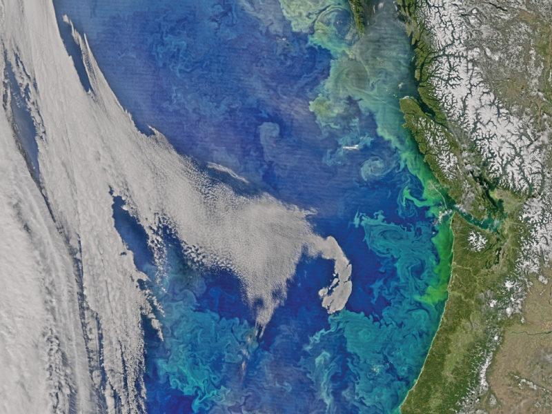
The American Pacific Northwest is at increasing risk from ocean acidification and reduced oxygen content with warming. Image from MODIS/VIIRS composite collected on March 30, 2016 via NASA GSFC Ocean Biology Processing Group.
Forty years of satellite remote sensing measurements of ocean color, sea surface temperature, and sea surface salinity are managed, archived and distributed by NASA's Ocean Biology Distributed Active Archive Center (OB.DAAC) at Goddard Space Flight Center (GSFC). This presentation explores the history and evolution of satellite-borne ocean color sensors and provides an overview of how to discover and access OB.DAAC data, services, and tools.
View this webinar to learn about the impact of past and present sensors, and how future platforms will contribute toward a growing NASA oceanography data archive.
View this webinar on YouTube 

Speaker
Robert Lossing, Satellite Remote Sensing Oceanographer and Scientific Software Engineer
Robert has supported the Ocean Biology Processing Group (OBPG) and the Ocean Biology Distributed Active Archive (OB.DAAC) at the NASA Goddard Space Flight Center for 7 years. He is interested in hyperspectral remote sensing, phytoplankton functional types, global biogeochemical satellite data assimilation and modeling, paleo phytoplankton primary productivity, science communication, and big data analysis methods Register Now 
