Early Adopter

Applied Research Topic
Near Real Time Satellite Data Distribution Platform for Central America: Monitoring and Fisheries Applications (pezCA)
Potential Applications ► Mobile app for fishing and recreation
Description
Developed by the Federación Costarricense de Pesca (FECOP) in Costa Rica under agreement with the national fisheries agency, Incopesca, pezCA is a near-real-time satellite and model data distribution platform for the Central America region designed to allow monitoring of the ocean conditions while promoting good fishing practices. pezCA allows free access to information, even while offline, offering updated maps of sea surface temperature, chlorophyll concentration, currents speed and direction, altimetry, bathymetry, and the depth of the thermocline. In addition, tide forecast, moon phases, and fishing information are available.Significance
Support of recreational fishing sector, support of government organizations and decision-making process (monitoring of oceanographic conditions, climate change, effects of El Niño), support of academic sector (first source of near-real-time satellite data for Central America specifically that will also serve research purposes).Why PACE
As a future source of operational data, PACE will represent a valuable source of ocean color data that will eventually replace the MODIS (sea surface temperature, chlorophyll-a) datasets in use currently and provide additional products related to phytoplankton functional types and red tides that are currently lacking.End User(s)
Recreational anglers, commercial fishermen, tourism agents, Non-government organizations, government officials (INCOPESCA), academiaSAT Partner(s)
Brian BarnesPublications
pezCA has been featured in many fishing publications (Coastal Angler, The Fishingwire, and Sport Fishing magazines), as well as printed (Tico Times) and TV media (Local News – Channel 6).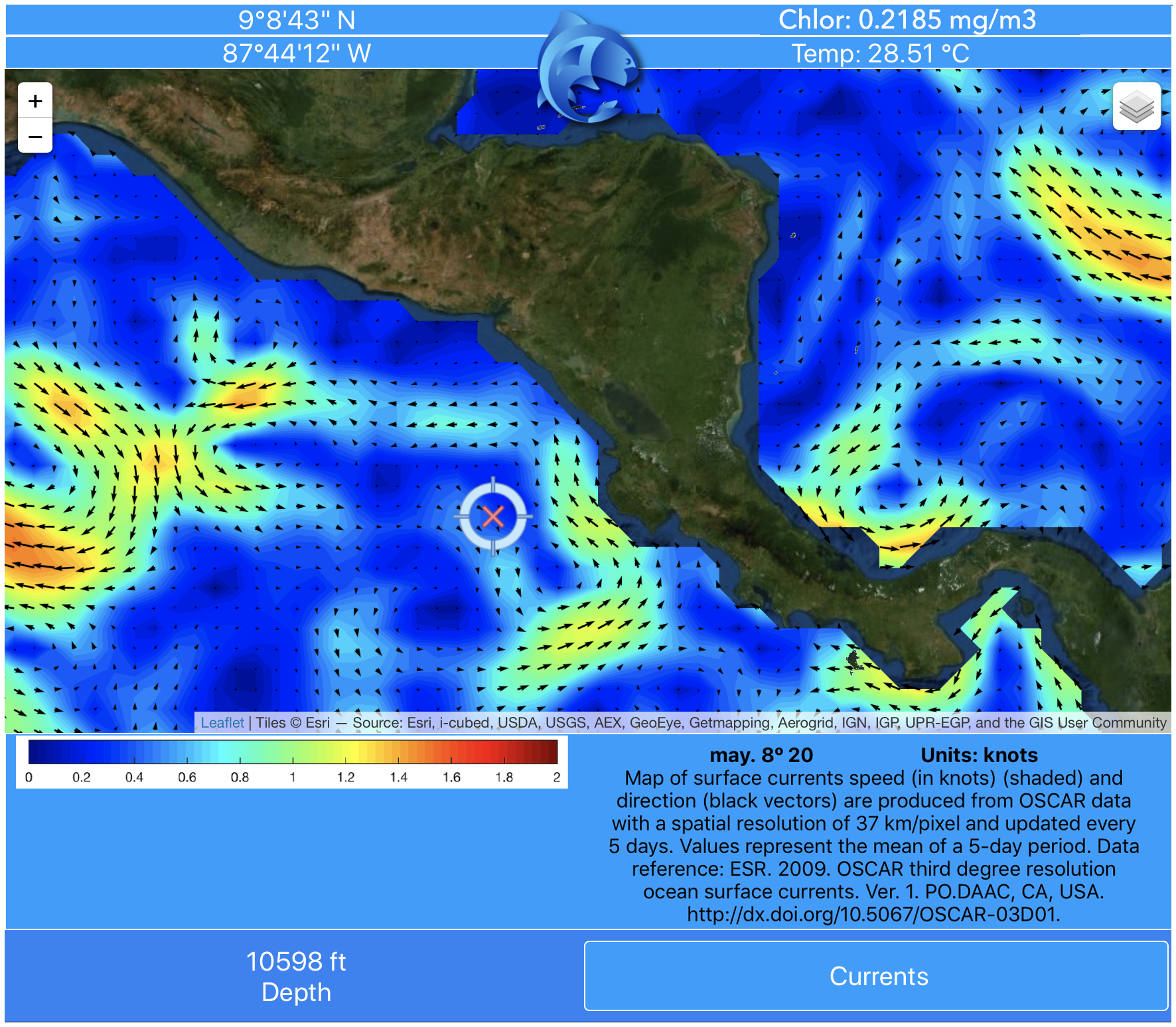
Information on currents around Central America from pezCA. Cross-hairs pinpoint a location off the west coast whose coordinates, temperature, chlorophyll concentration, and depth are shown.
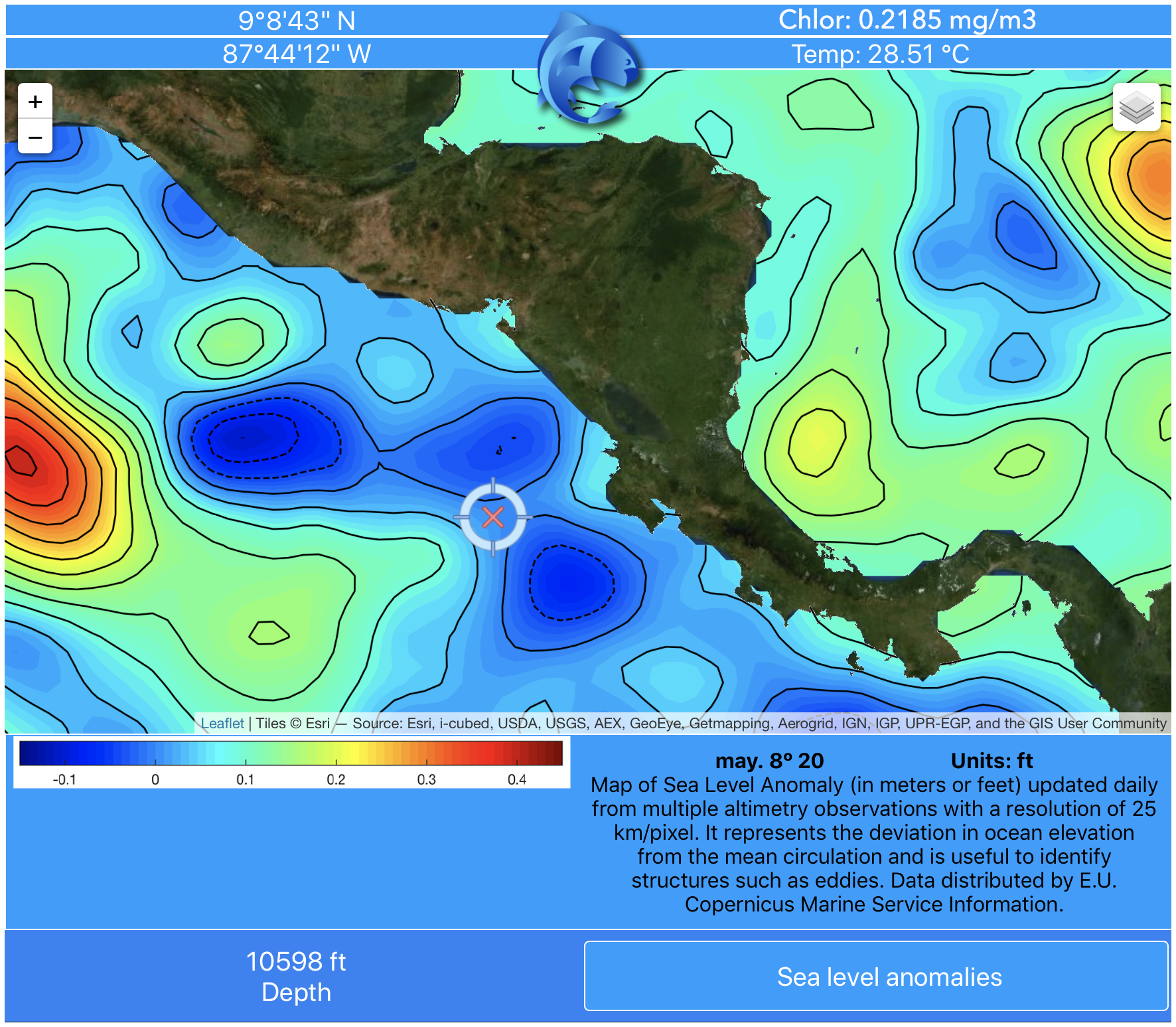
Sea level anomaly data map off Central America from pezCA. Cross-hairs pinpoint a location off the west coast whose coordinates, temperature, chlorophyll concentration, and depth are shown.

Sea surface temperature data map off Central America from pezCA. Cross-hairs pinpoint a location off the west coast whose coordinates, temperature, chlorophyll concentration, and depth are shown.