Recent PACE Data Maps
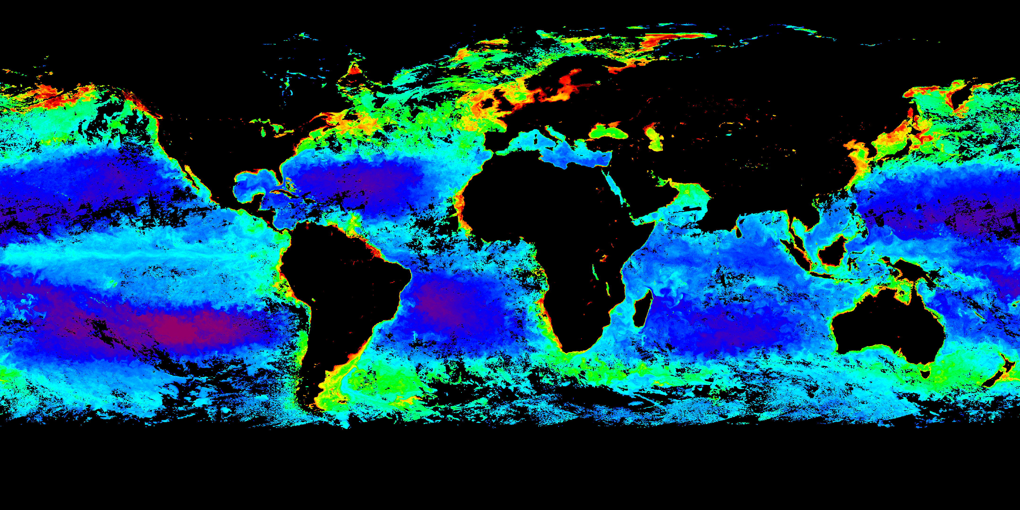
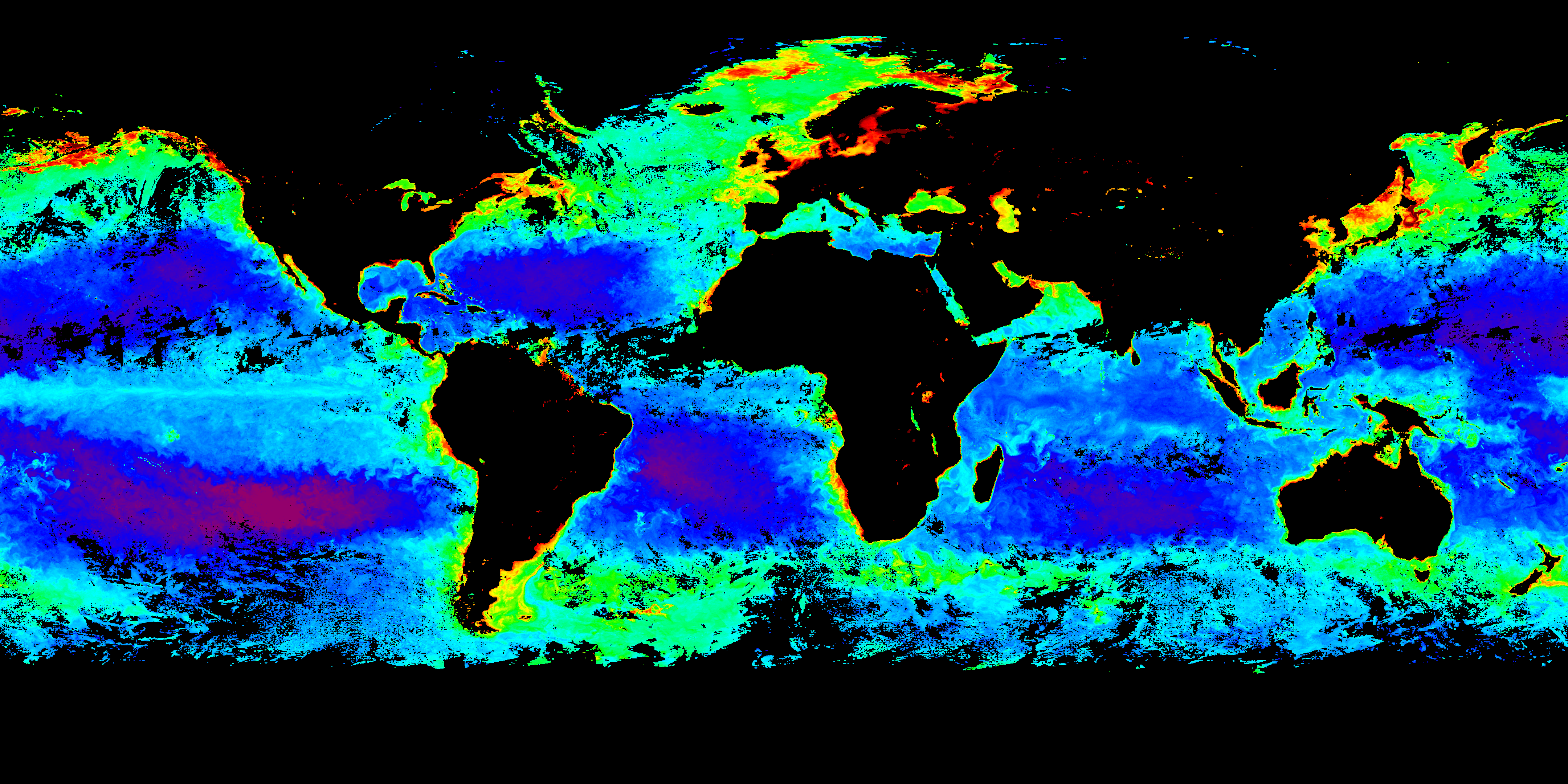
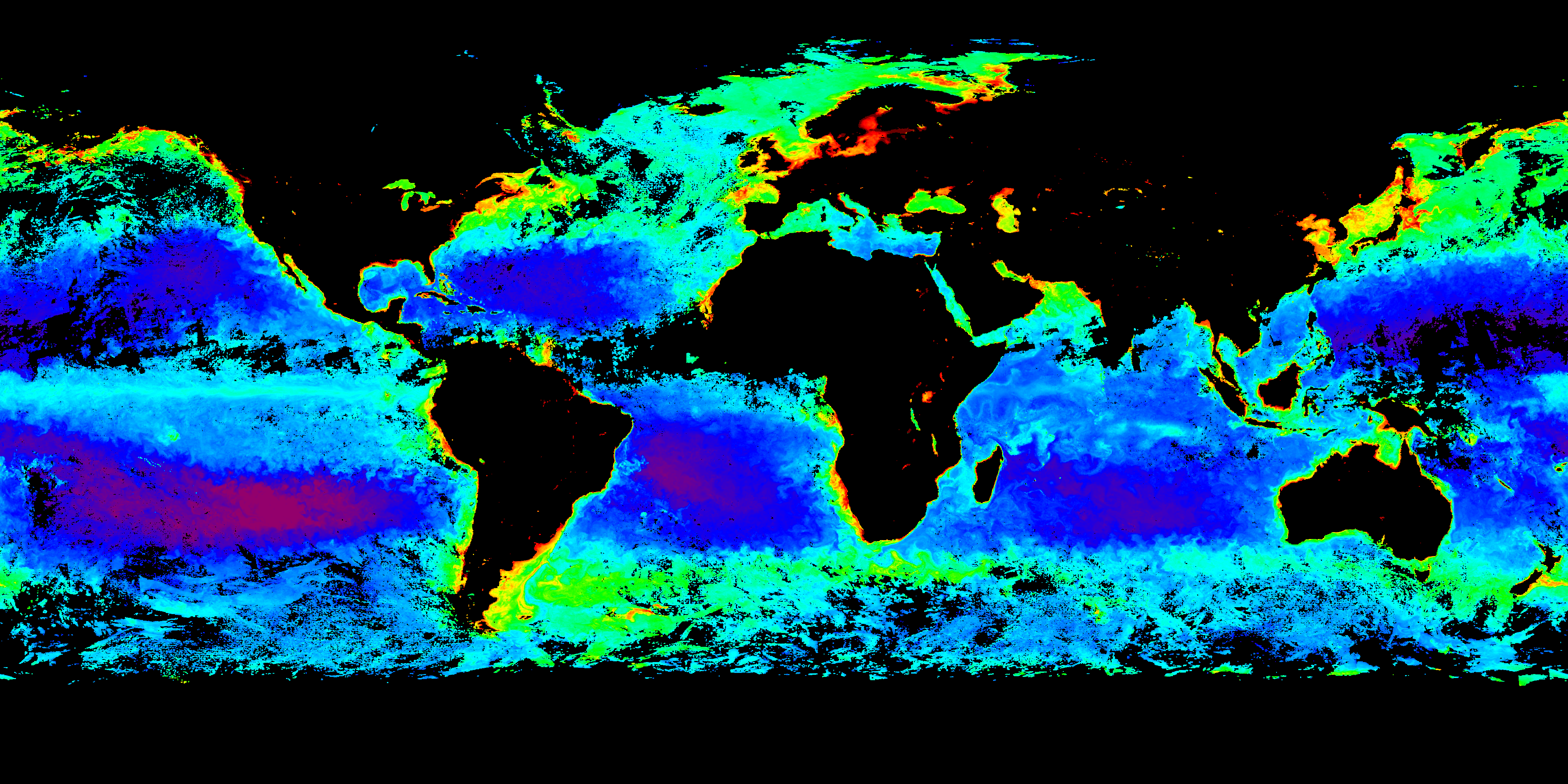
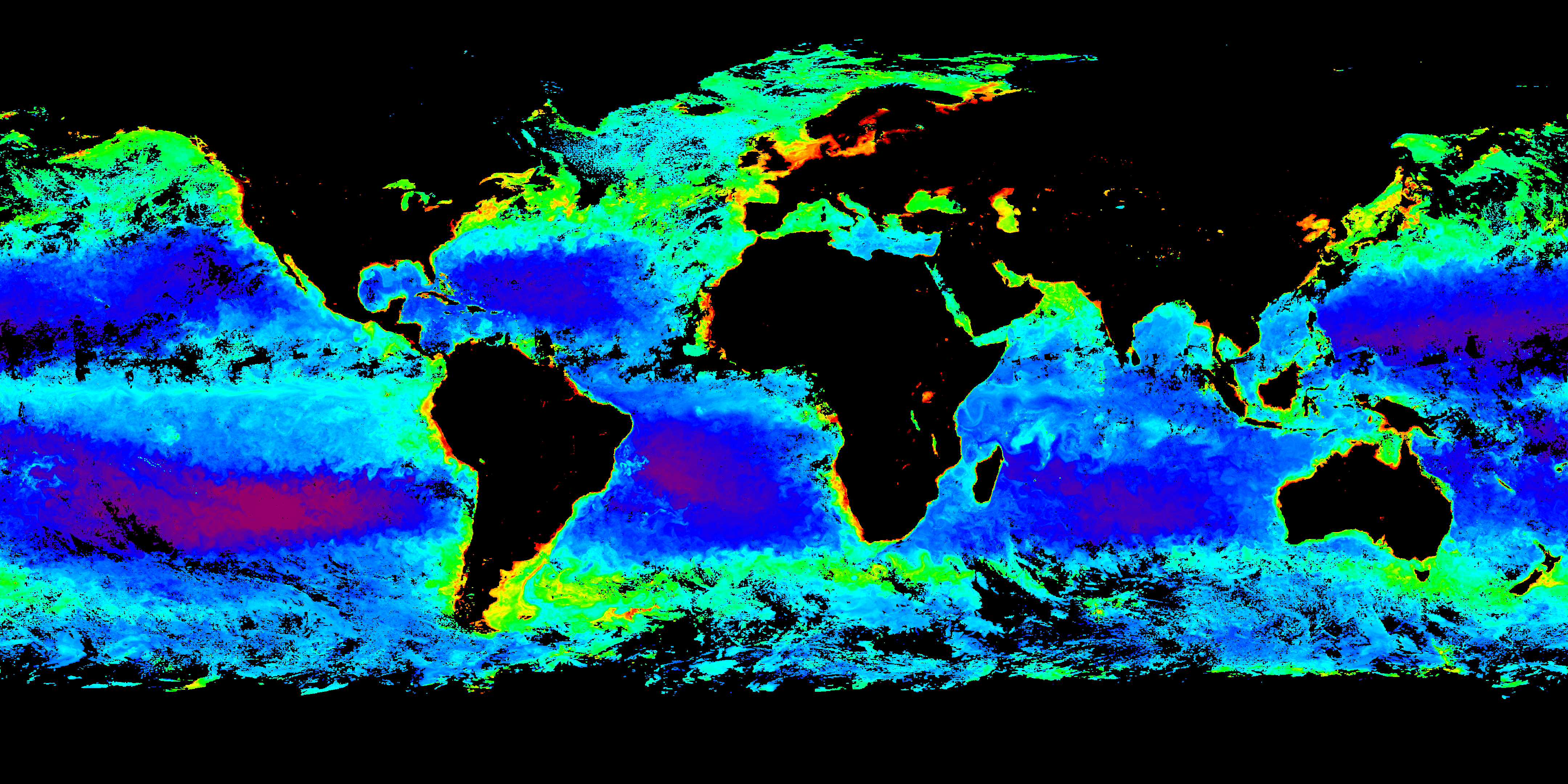
Chlorophyll Concentration | Land Vegetation IndicesPACE Chlorophyll is the near-surface concentration of the green pigment, chlorophyll a, at the ocean surface. Found in tiny photosynthetic organisms – phytoplankton – chlorophyll is a measure of ocean ecosystem health. These standard PACE-OCI maps are available from the Ocean Biology Distributed Active Archive Center (OB.DAAC).
Colors in these provisional products indicate the concentration of chlorophyll in our ocean averaged over eight days. Click on the images (below) for a closer view. From there, you can click the left/right arrows to move between maps.

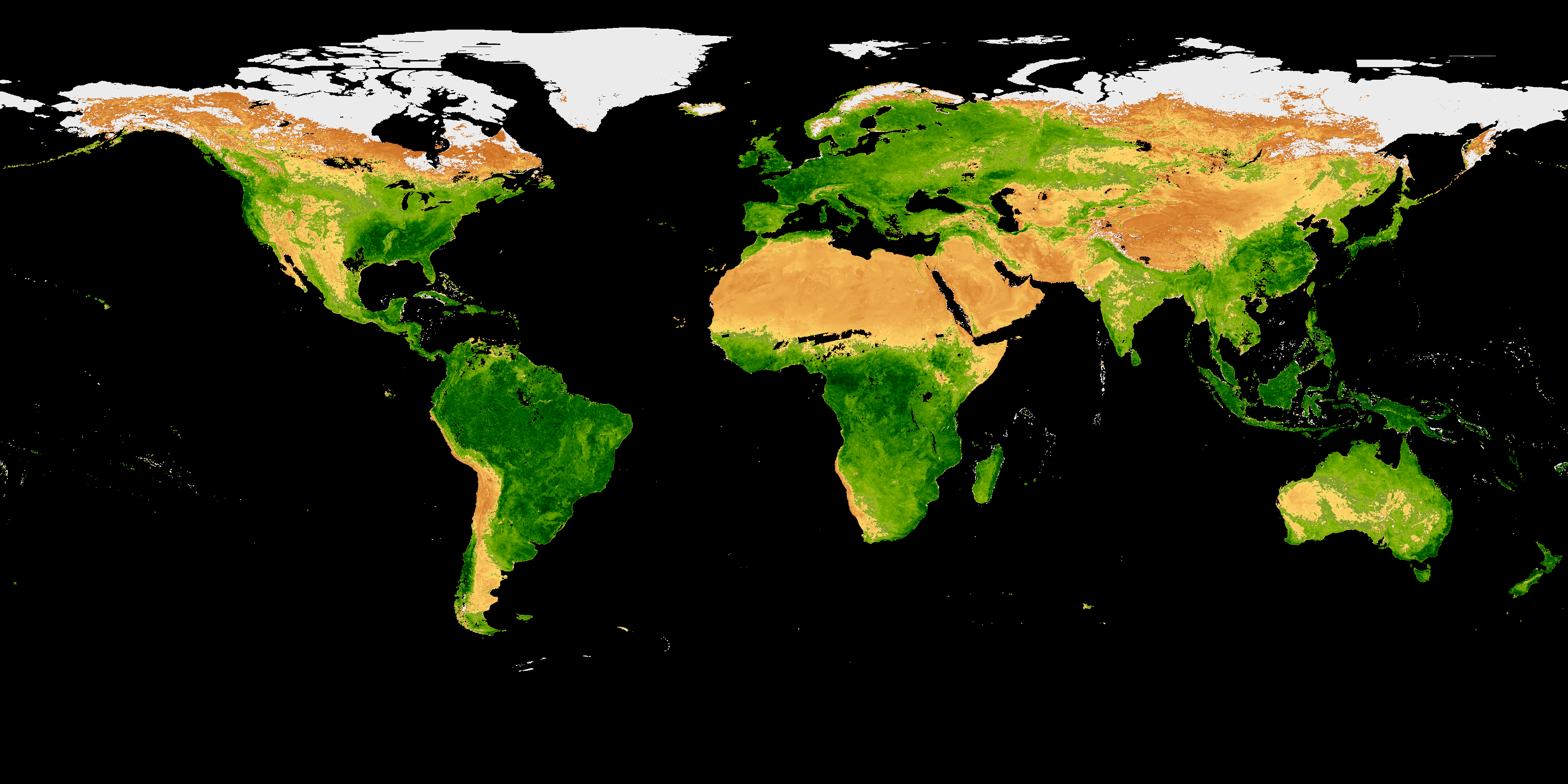
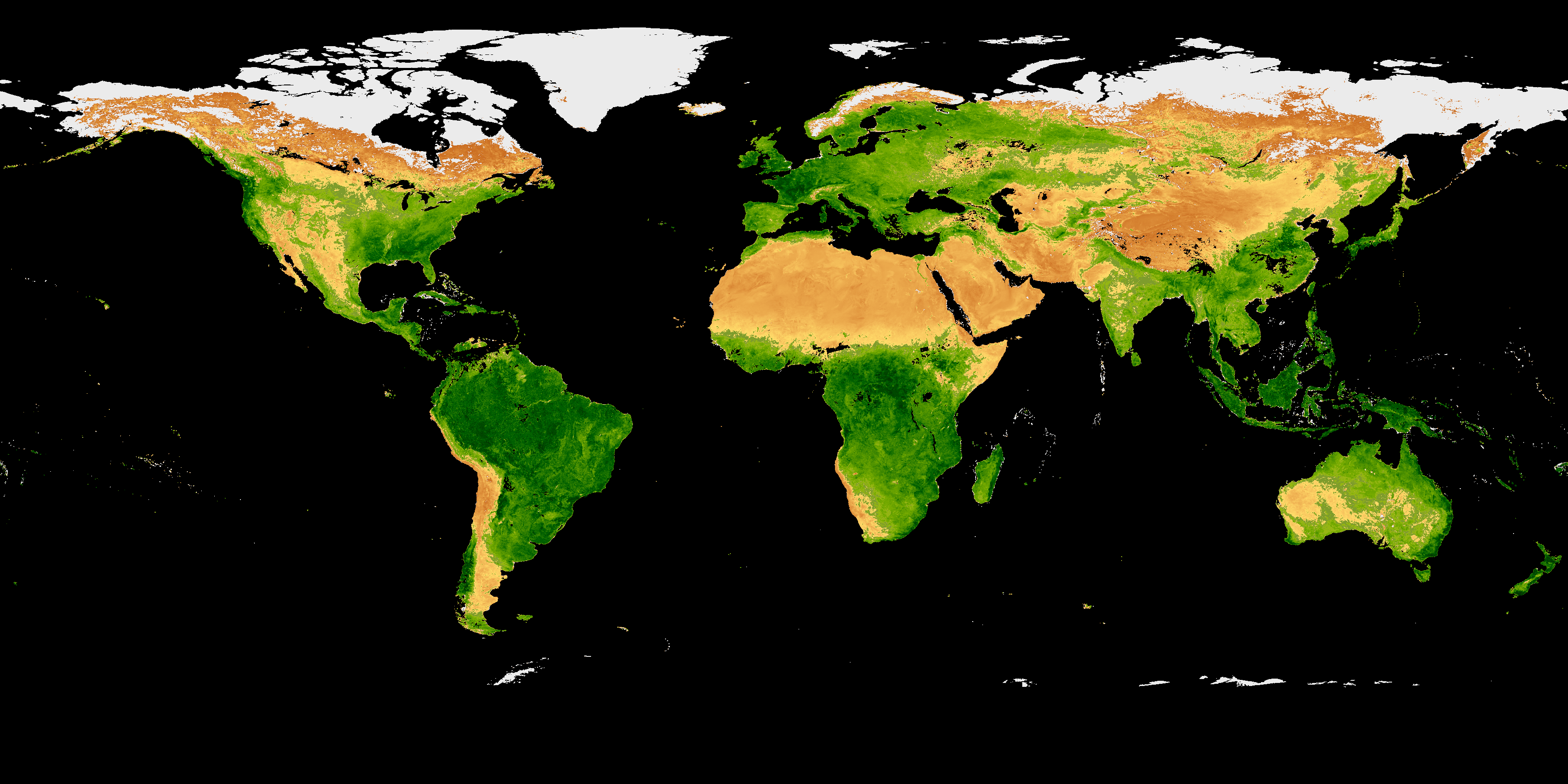
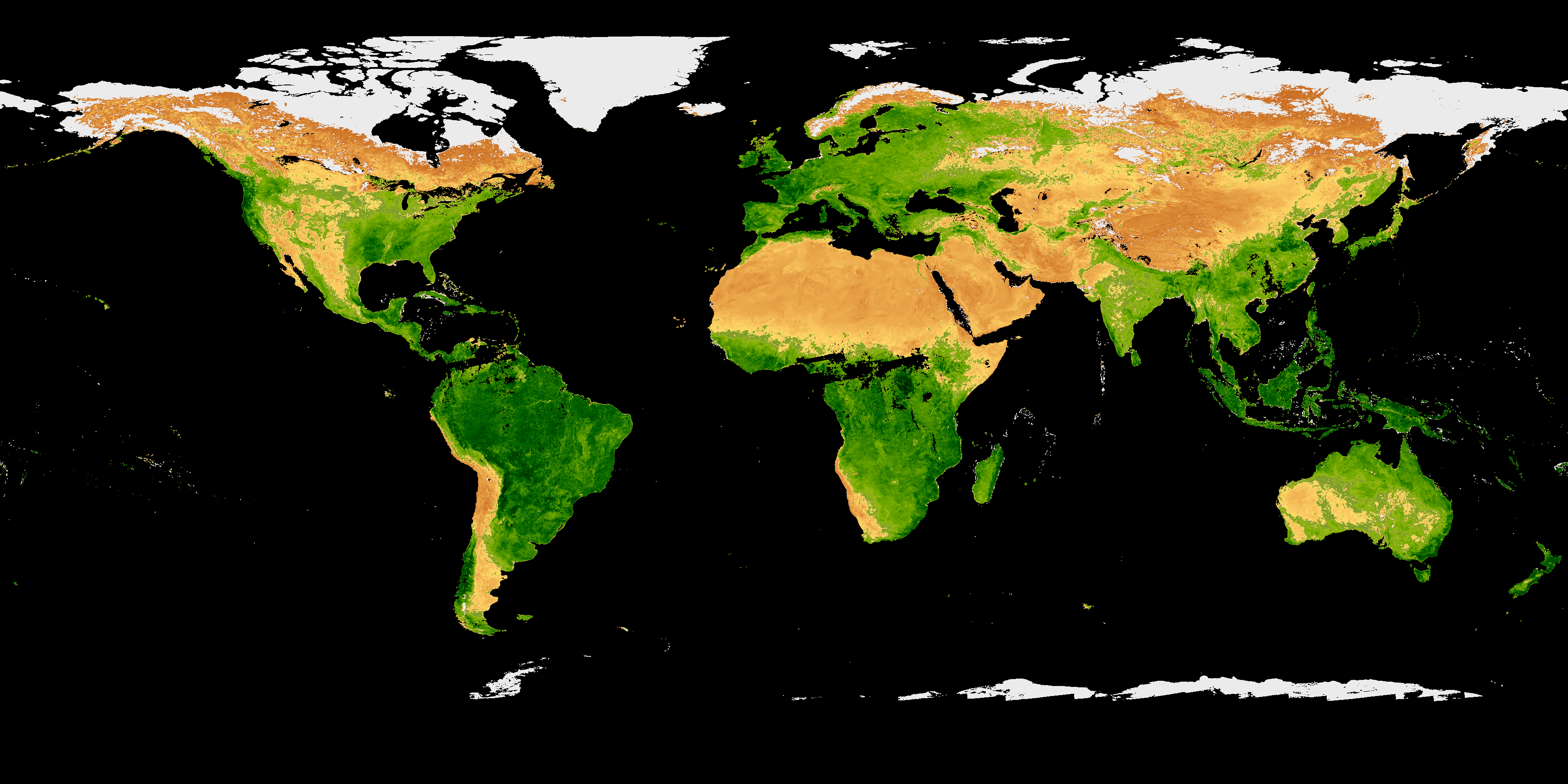
PACE Land Vegetation Indices tell us about the “greenness” or photosynthetic activity of plants on land. Healthy plants – with abundant chlorophyll and cell structures – appear as green colors. Areas with sparse or unhealthy vegetation appear brown. Ice or snow-covered areas appear white. These provisional PACE-OCI maps are available from the Ocean Biology Distributed Active Archive Center (OB.DAAC).
Colors in these provisional products indicate the health and abundance of vegetation on land averaged over eight days. Click on the images (below) for a closer view. From there, you can click the left/right arrows to move between maps.