|
Mission Spotlight
NASA's PACE-OCI Provides Novel Detail in Tracking Nitrogen Dioxide and Ozone
Launched in February 2024, the Ocean Color Instrument (OCI) aboard NASA's PACE satellite was designed to advance space-based monitoring of our ocean and atmosphere by innovating how particles in the air (aerosols), clouds, and ocean ecosystems are observed. Researchers have discovered that OCI can also measure the vertical column density of nitrogen dioxide (NO2) and ozone (O3) with unprecedented spatial detail...
Read more »
Mission Updates
|
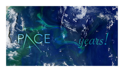
Celebrating Two Years of PACE in Space!
February 8, 2026 marks two incredible years since PACE launched, revolutionizing our understanding of Earth's ocean and atmosphere. Over these two years, PACE has delivered unprecedented hyperspectral observations, advancing research in ocean ecology, aerosol science, and climate studies.
From tracking harmful algal blooms with unprecedented detail to monitoring atmospheric aerosols and their interactions with clouds, PACE continues to provide scientists with the data needed to understand our changing planet.
🎉 Happy 2nd Anniversary, PACE! 🎉
|
|
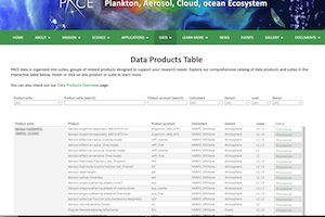
New PACE data products table
The PACE data products table has been updated! Explore our comprehensive catalog of data products and suites in the newly interactive table.
Explore the table »
|
|
|
Earthdata Web Unification
NASA Earth science data sites are being consolidated under the Earthdata domain from now until end of 2026, which will impact Ocean Color Web resources. During this process you will find redirects as pages move to their new locations. Thank you for your patience as we make this transition.
Learn More About Web Unification »
|
|
How is the PACE Ocean Color Instrument (OCI) performing?
The PACE OCI Calibration Team continuously evaluates the on-orbit radiometric performance of OCI.
View OCI Trending Plots »
|
PACE in Action
See how PACE data is being used around the world to advance ocean science and applications.
|
Thank You for Making the 2026 the PACE Applications Workshop a Success!
March 11 & 12th, 2026 • Virtual Event
-
1300+ registrants from 60+ countries with 700+ live attendees
-
2 days, 5 sessions covering PACE updates, impact, and case studies across ocean, land & atmospheric domains
-
29 speakers showcased PACE capabilities, including 6 Early Adopters, 3 Science & Applications Team Members, plus inter-agency and private sector collaborators
-
9 capacity building tutorials demonstrating data access across NASA Earthdata, ArcGIS, Google Earth Engine, Python, and more
View Event Archive »
|
|
|
|
|
pml.ac.uk
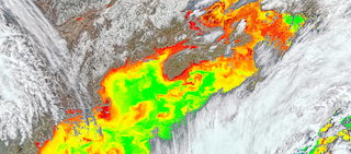
Joining forces on harmful algae: PML leads satellite project with NZ partner
Plymouth Marine Laboratory leads an international collaboration using PACE satellite data to monitor harmful algal blooms in partnership with New Zealand researchers.
Read More »
|
|

|
|
linkedin.com
PACE as part of Esri showcasing innovative data capabilities from NASA
Esri highlights PACE data as part of their innovative geospatial data capabilities, demonstrating the integration of NASA Earth observation data into GIS platforms.
View Article »
|
|
|
|
accessnewswire.com
PACE as part of NASA ESD's efforts to serve fisheries with NASA EO data
NASA Earth Science Division researchers integrate PACE data into comprehensive efforts to support marine fisheries management with Earth observation data.
Read More »
|
|
|
|
spie.org
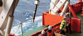
Ocean sentinels
SPIE Photonics Focus explores how PACE data works in conjunction with ocean sensing platforms like BGC-Argo floats to monitor ocean nutrient cycles and marine ecosystems.
Explore Article »
|
|
|
SHARE YOUR PACE STORY!
We're collecting stories to highlight the real-world value of PACE
across public and private sector science and
applications efforts worldwide.
Share your research
breakthroughs, creative applications, or inspiring discoveries.
We want to help spread the word about your impact!
Connect with us at:
[email protected]
|
Upcoming Events & Opportunities
Don't miss these upcoming conferences, workshops, and training opportunities to connect with the PACE
community.
|
Watch your PACE Community email & our
Events page for PACE community event news!
|
General Community Events
|
Mark Your Calendar:
|
May 1, 2026 |
Ocean Optics XXVII (Sep. 13-18, 2026) Early Registration and Abstract Submission Deadline
Register Now » |
|
May 4-8, 2026 |
ForestSAT 2026 Conference (Hybrid), Gainesville, FL |
Visit PACE's Special Session » |
|
June 1-12, 2026 |
Cornell Summer Satellite Remote Sensing Workshop
Apply Now » |
|
Aug. 17-21, 2026 |
GO-BGC Float Data and Science Workshop, University of Washington, Seattle, USA
Apply » |
|
Opportunities
|
Current Openings:
|
Apply by Apr. 2, 2026 |
Postdoc Opportunity: Effect of Wildfires on Ocean Biogeochemistry
Apply Now » |
|
PACE in the News
People are talking about PACE!
|
science.nasa.gov
Keeping Up with PACE: Summary of the 2025 PAC3 Meeting
The third PACE Applications and Community Collaboration (PAC3) meeting brought together scientists, researchers, and stakeholders to discuss the latest developments and applications of PACE data.
Read Full Summary »
|
|
|
|
spinoff.nasa.gov
Forecasting Fish from Space
NASA's PACE satellite is revolutionizing fisheries management by providing unprecedented insights into ocean ecosystems and fish populations from space.
Read More »
|
|
|
|
earthdata.nasa.gov
New PACE Imagery Services in ArcGIS Living Atlas
PACE data is now available through ArcGIS Living Atlas of the World, making it easier for GIS users to access and analyze ocean color data.
Learn More »
|
|

|
|
science.nasa.gov
Ailing "Megaberg" Sparks Surge of Microscopic Life
NASA's Earth Observatory explores how a massive iceberg's journey sparked a bloom of marine life, as observed by PACE and other Earth-observing satellites.
Read Story »
|
|
|
|
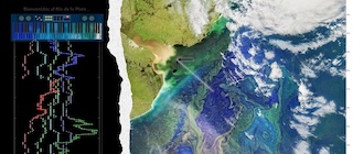
ciencia.nasa.gov
Una imagen satelital del Río de la Plata se convierte en melodía
A PACE satellite image of the Río de la Plata becomes melody in an innovative musical project that transforms Earth observation data into art.
Explorar Proyecto »
|
|
Research Highlights
Discover the latest scientific breakthroughs and publications featuring PACE data.
Help
Hub Corner
Satellite data processing can be difficult - we're here to help you climb out of that hole.

|
HELP HUB NOW IN 100+ LANGUAGES!
Global accessibility upgrade
The Help Hub is now available in over 100 languages! Use the translation widget in the top-left of the page to translate the text while leaving the code intact.
Find the latest tutorials and notebooks from The OEL at NASA, including multiple Jupyter Notebooks using PACE data and SeaDAS video tutorials.
|
|
Tools and Resources
|
Fish-PACE Hackweek Resource Book
NOAA's 2026 Fish-PACE hackweek taught participants to work with the new PACE hyperspectral data and tackle applications for fisheries and ocean ecosystem research. Their resource book is available online. Take a look and save the link!
Access Resource Book »
|
|
Winter 2026 – PACE Land Data Users' Group
Our third PACE Land data Users' Group (PLUG) and first meeting of 2026 provided the latest on the PACE mission plus two presentations on terrestrial work being conducted with PACE's unique land data. Please see the Event Archive for a recording of the meeting, presentation slides, and code repository locations.
View Event Archive »
|
Educational Materials
Inspiring the next generation of Earth scientists with PACE data and educational resources.
|
Educational Videos and Curricula
Ivona Cetinć worked with the NASA eClips team to produce a series of incredible resources for educators. Share widely!
|
|
|
|
Interactive Learning Tools
|
3D VISUALIZATION
Cyclone Courtney: A 3D Cloud Bonanza
Ever wonder what storm clouds really look like in 3D? Try four different ways to visualize NASA satellite data of Cyclone Courtney, including red-cyan anaglyph, interactive 3D, wiggle animation, and yes, a Magic Eye stereogram with full thematic 90s aesthetic!
Explore
3D Clouds »
|
|
|
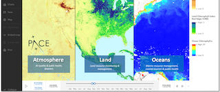
INTERACTIVE WEB-APPLICATION
PACE data now in the Earth System Data Explorer (ESDE)!
ESDE is an interactive tool designed for students and educators to visualize and work with NASA Earth science datasets. For PACE data, look under Biosphere to find multiple phytoplankton types and terrestrial vegetation indices from PACE.
Try
ESDE »
|
|
PACE in Images
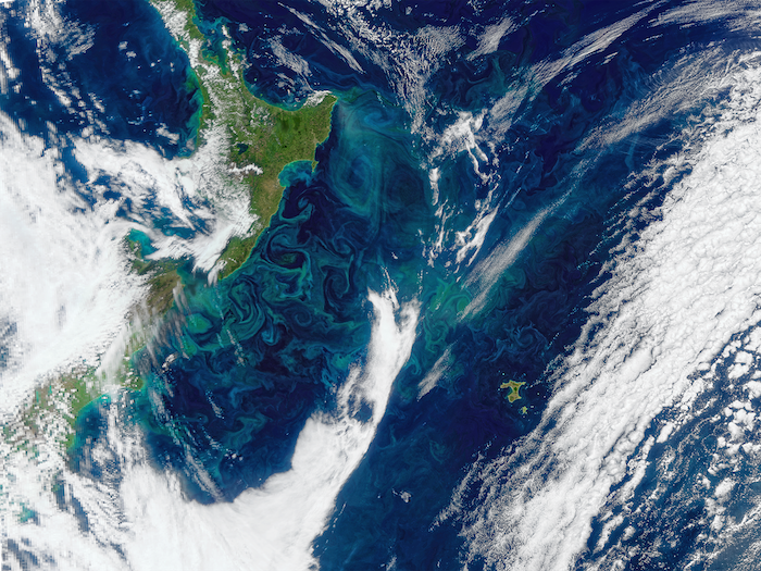
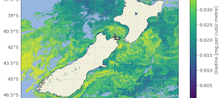
Chatham Islands Bloom
A summer phytoplankton bloom is seen off the east coast of New Zealand, extending to Chatham Islands...
Learn More »
|
3 Ways to View Cyclone Courtney
From the "Cyclone Courtney: A 3D Cloud Bonanza" blog post, explore different ways to visualize storm clouds in 3D:
Read the full blog post »

Cloud Top Height 2D
Traditional 2D representation
|
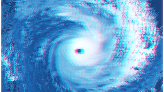
Red-Cyan Anaglyph
3D glasses required
|
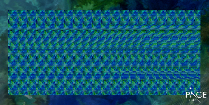
Magic Eye Stereogram
Cross your eyes or look "through" the image to see the 3D effect
|
|
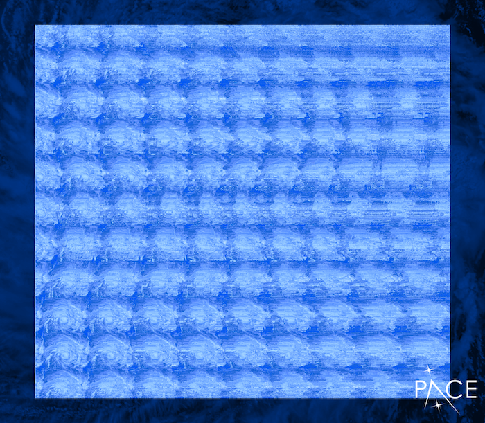
Bonus PACE Stereogram!
An extra Magic Eye stereogram featuring PACE imagery. Relax your eyes and look "through" the image to see the hidden 3D effect.
Start close to the screen and slowly move back while keeping your eyes relaxed!
|
Outreach & Engagement
|
Ocean Sciences Meeting 2026, Glasgow, Scotland
On February 25, Susanne Craig chaired a session named "Invisible Giants: Exploring Phytoplankton Ecology at Oceanic Scales" at the 2026 Ocean Sciences meeting in Glasgow, Scotland, bringing together researchers from around the world to discuss PACE science applications.
View Poster Session Program »
|
View Oral Session Program »
|
|
PACE Scavenger Hunt Program Expands
PACE outreach continued its work with its PACE-scavenger hunt program. In March, the team hosted scientist nights at the Bowie and Hyattsville Libraries in Prince George's County and connected with over 30 students to learn about the mission. What do phytoplankton, satellites, and scavenger hunts have in common? They're all coming together at local libraries through this new family-friendly outreach activity inspired by NASA's ocean science.
Read More About the Program »
|
|
|
|
Join the Library Scavenger Hunt Program
PACE team members have launched a new library-based scavenger hunt designed to introduce patrons to the fascinating world of phytoplankton.
We kicked off the program at the Cleveland Park Library in Washington, D.C. and plan to reach 10 libraries and beyond in 2026.
|
Behind the Scenes
Meet the dedicated team members behind PACE who bring expertise and passion to our mission.
SSAI Spotlight
Dr. Ryan O'Shea
Science Systems and Applications, Inc. (SSAI) commemorates World Wetlands Day in this podcast with Dr. Ryan O'Shea, Senior Research Scientist, discussing his important work with wetlands research and PACE data applications.
View
podcast »
|
|
NASA Night Sky Network
Carina Poulin
Carina Poulin was hosted by the NASA Night Sky Network team to speak about her work in communicating PACE science to different audiences. Learn how she transforms complex ocean data into stunning scientific visualizations.
View
video »
|
|
Get
PACE Swag!
|
Land's End Store - Always Open
Customize a wide array of garments with mission, instrument and agency logos
Shop now »
|
Newsletter Team
|
This newsletter is brought to you by the
PACE Applications and Communications Teams:
Carina Poulin, Morgaine McKibben, and Sara Blumberg
Have something for the PACE newsletter?
Contact us at [email protected]
|

|
National Aeronautics and Space Administration
NASA
Goddard Space Flight Center
|
|
|
|