Early Adopter

Laboratory for Applied Science, Earth System Science Center, University of Alabama in Huntsville | Website
Applied Research Topic
Potential Applications ► Ecological conservation, forest management, space archaeology
Description
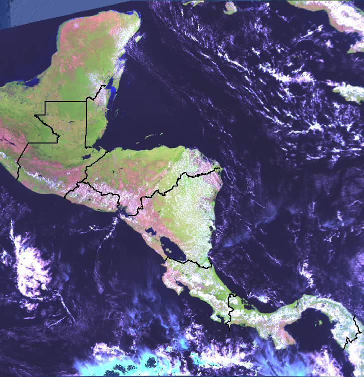
In line with the adage that "you can't manage what you can't measure," ecosystem maps are crucial tools for conservation. Toward that, in 1999 - twenty five years before the launch of NASA's PACE observatory - the World Bank and the Government of the Netherlands funded a critical effort to map the terrestrial ecosystems of Central America, long recognized as one of the world's biodiversity hotspots, but which had also been affected by widespread deforestation in the 1970s and the 1980s. By 2002, regional scientists had completed a map - based on visual interpretation of Landsat Thematic Mapper data (from NASA and the USGS) - which recognized almost 200 individual ecosystem types. In the almost quarter century since the publication of that effort, while access to spaceborne Earth observation data has grown exponentially, the Central American ecosystem mapping data have not been updated.
Given the launch of the PACE observatory in early 2024 and its unique hyperspectral imaging capabilities, we propose to utilize data from PACE's Ocean Color Instrument (OCI) to generate an updated version of a regional ecosystem map of Central America, also leveraging vegetation structural data from NASA’s Global Ecosystem Dynamics Investigation (GEDI) mission. Due to the large data volumes that will have to be managed, and given the PI’s status as a Google Developer Expert, the cloud-based Google Earth Engine (GEE) platform will be leveraged for this research effort. A dedicated open repository for processing PACE OCI data for terrestrial applications will be one of the outputs of this effort. This will also complement work that the PI and the co-I have done in the context of the Ecosystem & Carbon Management thematic area of the SERVIR program.
Significance
Central America's ecosystems are teeming with biodiversity, as it is estimated that almost 10% of the world's terrestrial species are found on the isthmus, which represents less than 1% of the world's landmass. Along with the connected part of southern Mexico, those ecosystems are collectively referred to as the Mesoamerican Biological Corridor, and regional policies have been in place since the early 1990s to ensure their collective preservation. That said, the existing national ecosystem maps are outdated, as they date back to 2001, and were developed using Landsat Thematic Mapper data. Remapping of those ecosystems using hyperspectral data could provide additional insights, including helping to inform national and regional conservation strategies. These activities can also influence ongoing archaeological research in northern Mesoamerica, which is also reliant on spaceborne data.
Why PACE
The national ecosystem maps generated for the Central American countries only made use of data from the 6 spectral bands of the Thematic Mapper (TM) sensors on Landsat-4 and Landsat-5. Given that the provisional surface reflectance product (version 3) from PACE OCI has 122 spectral bands - albeit at a coarser spatial resolution - we hypothesize that these will be appropriate for mapping terrestrial ecosystems. Where PACE will provide canopy-level insights into ecosystems, that data will also be combined with upscaled data from NASA's Global Ecosystem Dynamics Investigation (GEDI) mission, which will provide complementary insights into ecosystem structure.
End User(s)
- Centro Agronómico Tropical de Investigación y Enseñanza (CATIE) [Costa Rica]
- Centro de Estudios Ambientales y Biodiversidad of the Universidad del Valle de Guatemala (UVG) [Guatemala]
- Environmental Research Institute of the University of Belize (UB-ERI) [Belize]
- Geospatial Monitoring Unit of the Belize Forest Department [Belize]
- Ministerio de Medio Ambiente y Recursos Naturales (MARN) [El Salvador]
SAT Partner(s)
K. Fred HuemmrichPublications
Herndon, K.E., Griffin, R., Schroder, W., Murtha, T., Golden, C., Contreras, D.A., Cherrington, E.A., Wang, L., Barazsky, A., Van Kollias, G., Alcover Firpi, O. 2023. Google Earth Engine for archaeologists: An updated look at the progress and promise of remotely sensed big data. Journal of Archaeological Science: Reports, 50: 104094. DOI: https://doi.org/10.1016/j.jasrep.2023.104094
Crowley, M. A., Stuhlmacher, M., Trochim, E. D., Van Den Hoek, J., Pasquarella, V. J., Szeto, S. H., Howarth, J.T., Platt, R., Roy, S., Tellman, B., Chakraborty, T.C., Ignatius, A., Cherrington, E.A., Markert, K., Wu, Q., Madhusudan, M.D., Mayer, T., Cardille, J.A., Erickson, T., Moore, R., Clinton, N.E., Saah, D. 2023. Pillars of cloud-based Earth observation science education. AGU Advances, 4, e2023AV000894. DOI: https://doi.org/10.1029/2023AV000894
Cherrington, E.A., Griffin, R.E., Anderson, E.A., Hernandez Sandoval, B.E., Flores-Anderson, A.I., Muench, R.E., Markert, K.E., Adams, E.C., Limaye, A.S., Irwin, D.E. 2020. Use of public Earth observation data for tracking progress in sustainable management of coastal forest ecosystems in Belize, Central America. Remote Sensing of Environment, 245, 111798. DOI: https://doi.org/10.1016/j.rse.2020.111798
Flores-Anderson, A.I., Griffin, R.E., Dix, M., Romero-Oliva, C.S., Ochaeta, G., Skinner-Alvarado, J., Ramirez Moran, M.V., Hernandez Sandoval, B.E., Cherrington, E.A., Page, B., Barreno, F. 2020. Hyperspectral Satellite Remote Sensing of Water Quality in Lake Atitlán, Guatemala. Frontiers in Environmental Science, 8:7. DOI: http://dx.doi.org/10.3389/fenvs.2020.00007.
Hernandez, B., Flores, A., Garcia, B., Clemente, A., Moran, M., Cherrington, E.A., Oyuela, M., Smith, O., and J.M. Guardia. 2011. Satellite Monitoring of Lake Atitlan in Guatemala. Proceedings of the Second International Symposium on Building Knowledge Bridges for a Sustainable Water Future: 234-238. Panama City, Panama. November 2011.
Hernandez, B., Garcia, B., Garrish, V., Cherrington, E.A., Picado, F., Sempris, E. 2011. Mapa Centroamericana de cobertura y uso de la tierra, cambios de cobertura y uso de la tierra 1980-1990-2000-2010. Technical report, no. PREVDA/UGR/SER/14/08. Water Center for the Humid Tropics of Latin America and the Caribbean (CATHALAC). Panama City, Panama. 152 pp. DOI: http://dx.doi.org/10.13140/RG.2.2.16349.82409.