Early Adopter

Applied Research Topic
Potential Applications ► Water clarity and particle size detection as an indicator of estuary health
Description
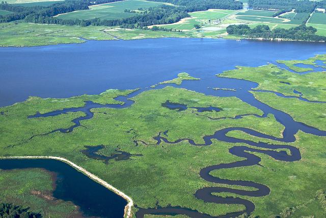
The Chesapeake Bay is an optically complex estuary with high seasonal and interannual variability in riverine inputs of nutrients and sediments. Its watershed is home to over 18 million people. Water quality in the estuary is of great concern to managers and residents in this region. Despite nutrient reductions, water clarity in terms of Secchi depth has declined over the past 30 years. This incongruity may be driven by a change in the composition or the size of suspended particles. In terms of particle composition, preliminary work suggests that fewer inorganic particles in suspension allow for more organic particles, which causes the water to appear cloudier in terms of Secchi depth. In terms of particle size, however, there is a lack of large-spatial-scale and large-temporal-scale particle size data. The goals of this project are to (1) improve estimation of water clarity from hyperspectral remote sensing reflectance in terms of variables such as diffuse light attenuation (Kd), Secchi depth, and total suspended solids (TSS); and (2) estimate particle size based on hyperspectral remote sensing reflectance. Using hyperspectral proxy datasets corresponding to future PACE data, we propose to (1) evaluate whether the increased spectral resolution improves estimates of water clarity variables and (2) estimate particle size using remote sensing reflectance in the 560-630nm wavelengths.Significance
Water clarity determines the success of submerged aquatic vegetation (SAV), which managers are concerned about because it is an indicator of a healthy estuary and it provides nursery habitat for juvenile blue crabs and striped bass, valuable commercial fisheries. Water clarity determines light available to phytoplankton, which in turn drives the spatial extent and duration of hypoxia in the Bay. Oyster growers have expressed a desire for monitoring data for their aquaculture sites using high temporal resolution satellite data, including variables like chlorophyll, water clarity, and TSS. At high TSS concentrations (low water clarity), bivalves’ feeding efficiency is negatively impacted. TSS concentrations are sometimes associated with the abundance of pathogens such as Vibrio spp. The Chesapeake Bay Program Scientific Technical Advisory Committee (STAC) uses water clarity information to help evaluate the health of the Bay. This group uses data from many sources to assign Total Maximum Daily Load (TMDL) criteria for the watershed. They assess how well the high-cost best management practices in the watershed are having an impact to improve water quality and water clarity in the estuary downstream.Why PACE
Hyperspectral remote sensing reflectance has the potential to (1) improve satellite-derived estimates of water clarity as measured with variables light attenuation (Kd), Secchi depth, and TSS, and (2) provide a means to estimate particle size. Relevant remote sensing reflectance spectra from the Hyperspectral Imager for the Coastal Ocean (HICO) for a variety of sub-environments within the lower Chesapeake Bay suggest that much of the variability in the remote sensing reflectance spectra is not captured by existing bands (Ibrahim et al. 2018). The variability that could be better captured by a hyperspectral sensor is particularly evident in the sampling gap of MODIS bands between approximately 560 and 630 nm wavelengths. It is likely that these wavelengths are important for the estimation of particle size in estuarine environments.End User(s)
Chesapeake Bay Program Modeling Workgroup (CBP WG)Chesapeake Bay Program Scientific, Technical Assessment and Reporting WorkGroup (CBP STAR)
Virginia Shellfish Aquaculture Industry Advisory Committee (SAIAC)
SAT Partner(s)
Emmanuel BossSnorre Stamnes
Publications
DeLuca, N., Zaitchik, B., & Curriero, F. (2018). Can Multispectral Information Improve Remotely Sensed Estimates of Total Suspended Solids? A Statistical Study in Chesapeake Bay. Remote Sensing, 10(9), 1393. https://doi.org/10.3390/rs10091393.
Gallegos, C. L., Werdell, P. J., & McClain, C. R. (2011). Long-term changes in light scattering in Chesapeake Bay inferred from Secchi depth, light attenuation, and remote sensing measurements. Journal of Geophysical Research: Oceans, 116(10), 1–19. DOI: https://doi.org/10.1029/2011JC007160.
Zhang, Y., Huang, Z., Chen, C., He, Y., & Jiang, T. (2015). Particle size distribution of river-suspended sediments determined by in situ measured remote-sensing reflectance. Applied Optics, 54(20), 6367. DOI: https://doi.org/10.1364/ao.54.006367.