Early Adopter

Applied Research Topic
Applying PACE products to Earth Observation (EO) Applications and Oceanographic Data Management - CEOS COVERAGE
Co-I: Jorge Vazquez, NASA Jet Propulsion Laboratory; CEOS COVERAGE project
Potential Applications ► Oceanographic data management and visualization toolkit- COVERAGE
Description
The CEOS Ocean Variables Enabling Research and Applications for GEO (COVERAGE) is a cross-cutting, formal initiative within CEOS (the Committee on Earth Observation Satellites). The overarching goal is to address key constraints to enable the more widespread, integrated use of satellite and in-situ ocean data in support of science and applications for societal benefit. COVERAGE's intent is to help emerging user communities, with less expertise working with EO data, more fully realize the potential of such multi-platform ocean observations. More specifically, COVERAGE involves the implementation of a cloud-based technology platform providing access to a curated set of complementary, fit-for-purpose, interagency satellite data from the four ocean virtual constellations (including ocean color) and select in-situ datasets via value-added data services across the web. These include data analytics and visualization services. The aim of this Early Adopter project is to demonstrate the utility of this generalized framework and reusable toolkit in the context of a thematic Ecosystem application example, relationship between high seas biodiversity and pelagic fisheries and the environment.Involvement in the PACE Early Adopter program allows COVERAGE and its community partners working on marine biodiversity and fisheries applications to become more familiar earlier on with novel hyperspectral satellite ocean color data from the mission, understand how best to leverage these products within their operations in future, and prepare accordingly. It will also provide opportunities for feedback on user needs, the design and general utility of PACE data products from the end-user perspective. Support for the kinds of higher data volumes from PACE and their provisioning in more accessible, analysis-ready form will require some consideration in advance of the necessary supporting data infrastructures. COVERAGE can serve as a valuable testbed for this, enabling the early integration of PACE data with other complementary ocean observations in a data system providing advanced, value-added services enabling synergistic ocean data use.
Significance
COVERAGE seeks to expand the accessibility of EO data for the oceans to a broader community of users with a particular emphasis on less expert remote sensing users and biological applications communities. The current thematic Ecosystem application focuses on high seas fisheries and marine biodiversity integrating extensive series of global catch/effort data for large pelagic species from Tuna Regional Fisheries Management Organizations (RFMOs), fishing vessel location data, and fish animal telemetry data with a curated set of interagency data to provide tools that will enable emerging ecosystem approaches to marine resource management involving the explicit use of environmental data. More specifically, these tools will facilitate improved understanding and decision in key areas including population and biodiversity responses to environmental variability and climate, species habitat characterization and utilization, by-catch mitigation, fishing closed area and marine protected area designation. COVERAGE development is thus characterized by a stakeholder and community-driven approach.Why PACE
COVERAGE is anticipating the needs and necessary data infrastructures for improved end-user access to the increasing data volumes coming from the next generation NASA ocean satellite missions. Given COVERAGE's ecological thematic focus area, PACE OCI ocean color data is not only timely but relevant. The increased quantity of hyperspectral resolution data that PACE OCI will provide requires some forethought and data planning, not only regarding the structure and design of the mission standard products, but also the value-added data services that will deliver and more seamlessly integrate those products with other oceanographic data streams to support the kinds of applications previously described. This will involve ingestion of high value PACE gridded (L3 or 4) multispectral ocean color products within COVERAGE as a complement to COVERAGE’s current baseline set of global interagency datasets for the range of key ocean parameters. This will enable synergistic use and inter-comparison of products via COVERAGE data visualization, analytics and colocation services in support of target marine biodiversity and fisheries applications. Extensions of COVERAGE’s L4 multi-mission gap-free ocean color product to include L2 PACE data as part of ongoing efforts to extend our current evaluation dataset to high resolution is a further area of interest and collaboration. Evaluation of PACE OCI simulated data and some pre-preparation for PACE mission data support within COVERAGE and ESDIS cloud-data infrastructures will also be integral to our efforts as participants in the Early Adopter program.End User(s)
GEO-Marine Biodiversity Observation Network (MBO)GEO-Blue Planet
GOOS-AniBOS (Animal-borne Observation Sensor network)
Sargasso Sea Commission (SSC)
Inter-American Tropical Tuna Commission (IATTC)
SAT Partner(s)
Chuanmin HuPublications
Tsontos, V., J. Vazquez, T. Chin, T. Huang, J. Jacob, J. Roberts, F. Platt. 2021. COVERAGE: Next Generation Data Service Infrastructure for a Digitally Integrated Ocean Observing System in Support of Marine Science and Ecosystem-Based Management. Marine Technology Society Journal. (In Press)
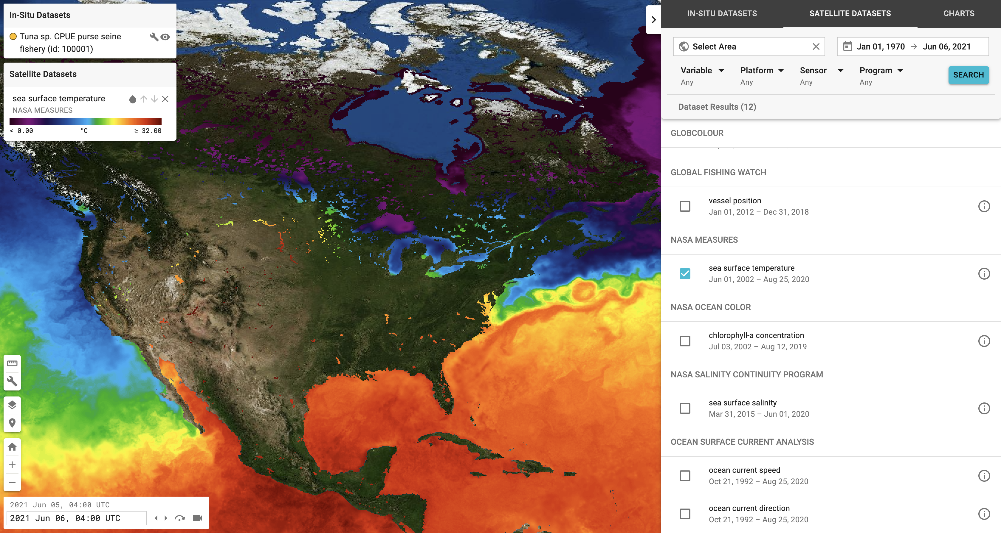
Example COVERAGE Data Tool output showing sea surface temperature data. This type of data is useful for tuna fisheries.
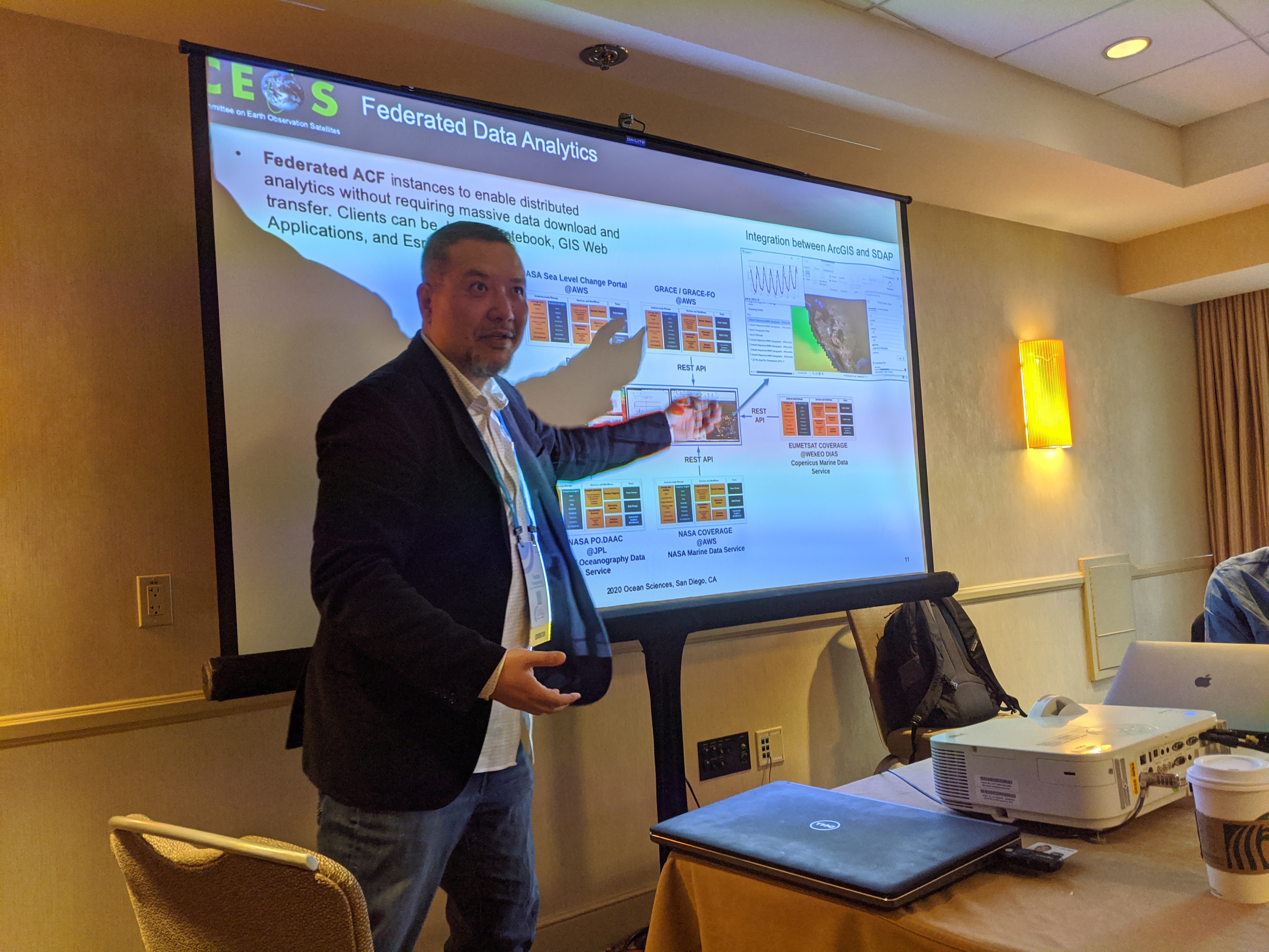
Thomas Huang (Jet Propulsion Laboratory / Caltech) gives a presentation about CEOS at the 2020 Ocean Sciences Meeting in San Diego, California.